
Introduction
Cáceres, affectionately known as the “Princess of the Paraguay,” is one of the fundamental pillars of the history and ecology of the Brazilian Northern Pantanal. Located in the state of Mato Grosso, the city rises on the banks of the majestic Paraguay River, serving as one of the main gateways to the Pantanal biome. Its foundation in 1778 responded to a strategic need of the Portuguese Crown to consolidate the colony’s western borders, creating an outpost that combined military defense with river commercial exploration.
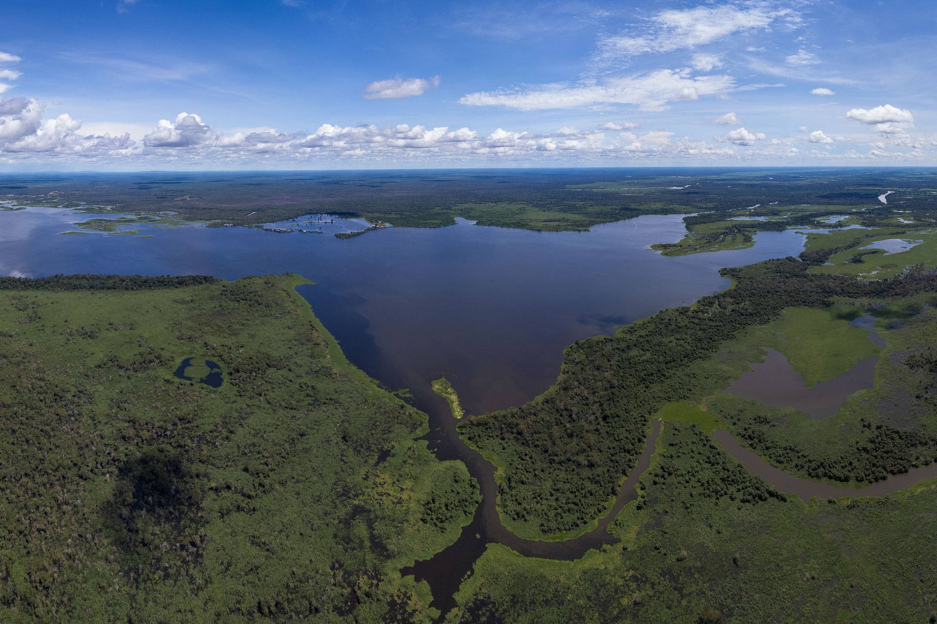
Geographically, Cáceres occupies a privileged position where the Cerrado meets the floodplains of the Pantanal. This biomic transition grants the region extraordinary biodiversity, making it a vital center for environmental conservation and contemplative tourism. The Paraguay River, which meanders through the city, is not just a water resource but the pulsing artery that defined the Cacerense identity, from the times of the great steam navigations to the present day, where it sustains sport fishing and river transport.
Culturally, the city is a mosaic of traditions reflecting its colonial heritage and its proximity to Bolivia. The Historic Center of Cáceres, with its eclectic buildings, is a silent witness to a past of opulence linked to ranching and river trade. Today, the city is world-renowned for hosting the International Sport Fishing Festival (FIPe), an event that attracts thousands of tourists and consolidates the municipality as the “National Capital of Sport Fishing.”
Geographical Classification
| Category | Information |
|---|---|
| Country | Brazil |
| State | Mato Grosso |
| Region | Northern Pantanal |
| Foundation | October 6, 1778 |
| Area | 24,351.396 km² |
| Altitude | 118 meters above sea level |
| Coordinates | 16° 04’ 14" S, 57° 40’ 44" W |
| Gentilic | Cacerense |
Demographic Data
| Indicator | Value |
|---|---|
| Population (2022) | 89,681 inhab. |
| Density | 3.68 inhab/km² |
| HDI | 0.708 (High) |
| GDP | R$ 2,543,890,000 |
History
The history of Cáceres is intrinsically linked to the expansion of the Portuguese Empire in South America. Founded on October 6, 1778, by Luiz de Albuquerque de Mello Pereira e Cáceres, the town was originally named Vila Maria do Paraguai, in honor of Queen Maria I of Portugal. Its location was chosen for its strategic importance in monitoring the Paraguay River and preventing Spanish advances from the Chaco region. For decades, Vila Maria served as a vital military and commercial outpost, connecting the interior of Mato Grosso to the Atlantic ports via the Platine basin.
During the 19th century, the city prospered with the development of extensive cattle ranching and the export of products such as rubber and ipecac (poaia). The arrival of steam navigation on the Paraguay River in the mid-1800s transformed Cáceres into a bustling river port, facilitating the exchange of goods and ideas with the rest of the world. In 1928, the city definitively adopted the name Cáceres, in honor of its founder, marking a new era of urban and administrative consolidation.
In the 20th century, Cáceres established itself as a regional hub for education and services. The creation of the State University of Mato Grosso (UNEMAT) in the 1970s brought a new intellectual and scientific dynamic to the city, fostering research on the Pantanal and the sustainable development of the region. Today, Cáceres balances its rich historical heritage with the challenges of modern conservation, remaining a vital reference for the understanding of the Pantanal’s socio-economic evolution.
Geography and Climate
Cáceres is located in the western part of Mato Grosso, in a region characterized by the transition between the Parecis plateau and the Pantanal depression. The relief is mostly flat, with some residual elevations such as the Serra do Facão. The hydrography is dominated by the Paraguay River and its tributaries, such as the Jauru, Sepotuba, and Cabaçal rivers. These rivers are essential for the maintenance of the flood cycle that defines the Pantanal, acting as the main drainage system for the entire region.
The climate is tropical, with a rainy season from October to March and a dry season from April to September. Average temperatures range from 24°C to 28°C, but can exceed 40°C during the summer. The “friagens” (cold fronts) are common in winter, bringing sudden temperature drops. The vegetation is a complex mosaic of Cerrado, gallery forests, and floodable fields, providing habitat for a vast array of wildlife, including the giant otter (Pteronura brasiliensis), the jabiru (Jabiru mycteria), and numerous fish species.
Economy
The economy of Cáceres is diversified, with strong roots in agribusiness, services, and tourism. Cattle ranching remains a fundamental pillar, with the municipality holding one of the largest herds in the state. In recent years, grain production, especially soybeans and corn, has expanded in the plateau areas. The service sector is driven by the city’s role as a regional hub for health, education, and commerce, serving several neighboring municipalities and even border regions of Bolivia.
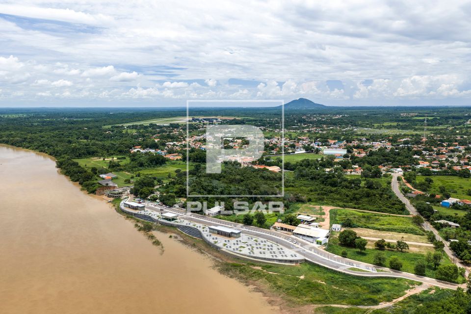
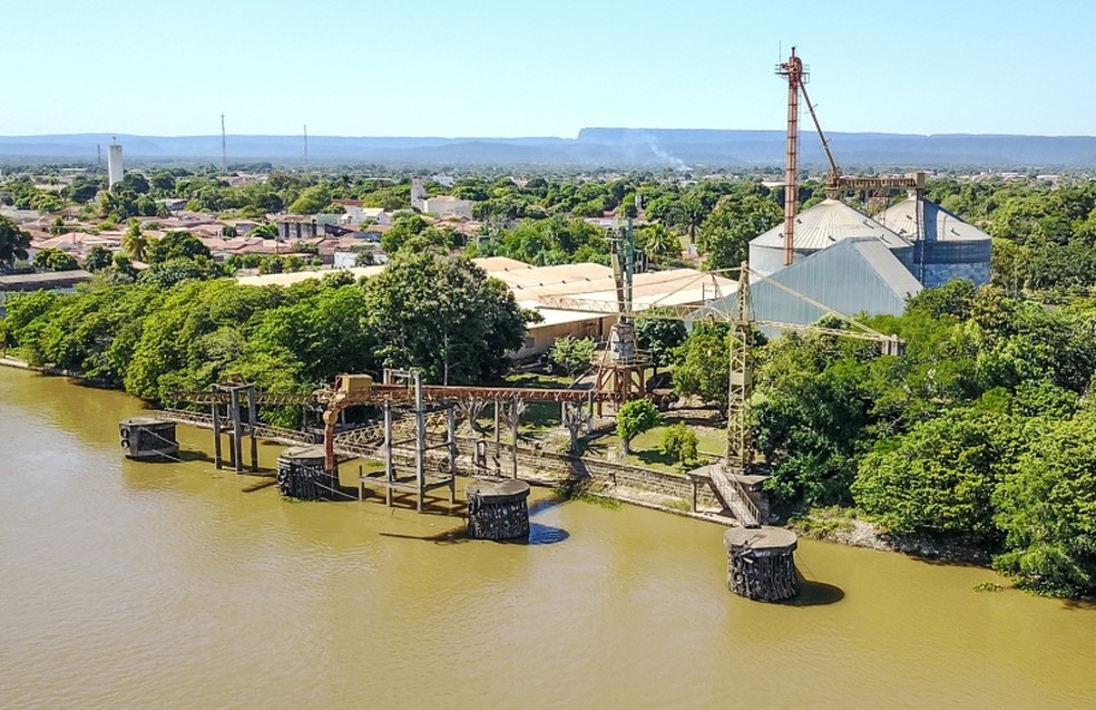
Tourism is a growing sector, centered on sport fishing and ecotourism. The International Sport Fishing Festival (FIPe) is the city’s main economic event, generating significant revenue and international visibility. Additionally, the proximity to the Pantanal attracts nature lovers and researchers, fostering a network of lodges, guides, and river transport services. The city also explores its potential for river logistics, with the Port of Cáceres playing a strategic role in the Paraguay-Paraná Waterway project.
Tourism and Attractions
Cáceres offers a unique blend of natural beauty and historical charm. The main attraction is the Paraguay River, where tourists can enjoy boat trips, sport fishing, and wildlife observation. The International Sport Fishing Festival (FIPe), held annually, is a major draw, featuring competitions, cultural shows, and gastronomic fairs. For nature enthusiasts, the Dolina Água Milagrosa, a deep sinkhole with crystal-clear blue water, is a must-visit spot for diving and contemplation.
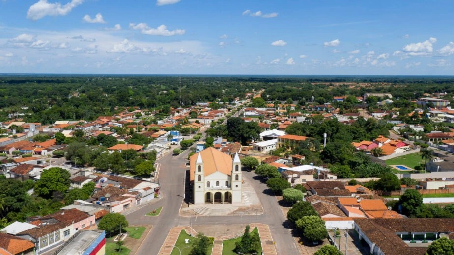
The city’s historical heritage is another significant attraction. The Historic Center features well-preserved buildings from the late 19th and early 20th centuries, such as the Jacobina Farm building and the São Luiz Cathedral, which boasts imposing architecture. The Cáceres Historical Museum houses a precious collection that narrates the city’s evolution from colonial times to the modern era, including indigenous artifacts and records of steam navigation. The local cuisine, rich in fish such as pacu, piraputanga, and pintado, completes the tourist experience, offering authentic flavors of the Pantanal.
Infrastructure
Cáceres has an infrastructure that reflects its importance as a regional hub and border city. In the transport sector, the city is served by federal highways BR-070 and BR-174, which ensure connection with Cuiabá, the interior of Mato Grosso, and the Bolivian border. The Cáceres Airport (SBCW) has undergone recent modernizations to handle regional flights, facilitating access for tourists and businesspeople. The Port of Cáceres, although with operations varying according to the river level, remains a strategic component for the Paraguay-Paraná Waterway project.
In the area of education, the city stands out as a university center, being the headquarters of the State University of Mato Grosso (UNEMAT). The institution plays a fundamental role in regional development, offering courses in various areas and fostering scientific research on the Pantanal biome. In the health sector, Cáceres has the Cáceres Regional Hospital, which serves a vast region of western Mato Grosso, in addition to several basic health units and specialized clinics, establishing itself as a reference in medical services for neighboring municipalities.
Importance for the Pantanal
Cáceres plays a crucial role in maintaining the ecological balance of the Pantanal. As it is situated at the headwaters of the biome, the management of water resources and environmental control in the municipality directly impact the entire floodplain downstream. The city functions as a “filter” and regulator of the water flow that feeds the Southern Pantanal, making local conservation policies vital for the survival of migratory species and for the maintenance of the flood and dry cycles that define Pantanal life.
In addition to ecological relevance, Cáceres is a center for the production of knowledge about the biome. Through UNEMAT and partnerships with environmental NGOs, the city hosts important research on biodiversity, climate change, and traditional communities. The involvement of local communities, such as artisanal fishers and riverine populations, in sustainable development projects demonstrates the city’s commitment to reconciling economic progress with the preservation of one of humanity’s most important natural heritages.
Fun Facts
- The city’s name is a tribute to Luiz de Albuquerque de Mello Pereira e Cáceres, the founder of Vila Maria do Paraguai.
- Cáceres holds the official title of “National Capital of Sport Fishing.”
- The Dolina Água Milagrosa is considered one of the best cave diving spots in Brazil, with waters that change color according to the season.
- The city was once an important center for exporting canned meat to Europe during the great world wars.
- The Jauru Landmark, a historical monument that delimited the borders between Portugal and Spain, was originally at the mouth of the Jauru River and is now in the main square of Cáceres.
References
[1] IBGE. (n.d.). Cáceres (MT) | Panorama. Available at: https://cidades.ibge.gov.br/brasil/mt/caceres/panorama [2] IBGE. (n.d.). Cáceres (MT) | History & Photos. Available at: https://cidades.ibge.gov.br/brasil/mt/caceres/historico [3] CÁCERES MUNICIPAL GOVERNMENT. (n.d.). History and Tourism. Available at: https://www.caceres.mt.gov.br/ [4] IPHAN. (n.d.). Historical Heritage of Cáceres. Available at: http://portal.iphan.gov.br/pagina/detalhes/367/ [5] SOS PANTANAL. (n.d.). Cáceres Microregion. Available at: https://sospantanal.org.br/pantanal/as-microrregioes-do-pantanal/caceres/